Work Package 1 “Rivers”

© iStock/CreativeNature_nl
WP1. Sustained high-resolution field observations in rivers
Responsible partner: WUR (Prof dr. A.J.F. Hoitink)
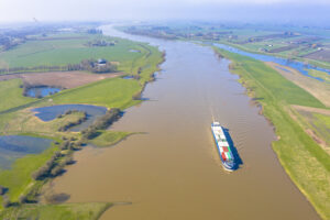
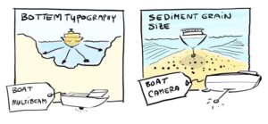
The core of the observation infrastructure for the river stem consists of three continuous monitoring stations that complement the existing monitoring station at Lobith, where the River Rhine enters The Netherlands. The locations are planned in the Upper Merwede, close to the tidal limit, in the Lower Merwede tidal river, and in the New Waterway near the outlet, where flow is highly stratified. At each of these stations, an array of instruments will be installed to collect horizontal profiles of velocity and suspended sediment, based on acoustics at multiple frequencies, optical monitoring and water sampling. Two key river bifurcations and two key tidal channel junctions will be subject to a periodic survey program with multiple ships, to monitor flow, bedload and suspended load sediment transport, grain size information of bed samples and suspended sediment, and salinity profiles at the junction where salt intrudes. The research infrastructure and periodic monitoring program is fully complementary to the existing monitoring network maintained by the Dutch water authority Rijkswaterstaat, which is strongly focused on water levels and discharge.
The sustained observation program of floodplains will focus on documenting vegetation dynamics, surface topography and floodplain water bodies. This will be done in contrasting areas, ranging from floodplains with active nature restoration and intensive channel-floodplain interaction to more isolated floodplains with commercial agriculture, and from upper reaches to the downstream, tidally influenced delta. The sustained observations will yield detailed long-term biogeomorphologic development data in the floodplains, and provide essential ground-truth and reference data for satellite-born multispectral remote sensing and national LIDAR height data from plane-borne surveys.

